
Refloow Geo Forensics: A Free Batch Image Geolocation and EXIF Forensics Tool for OSINT
An open-source Electron desktop app that extracts EXIF metadata from batches of JPG images, plots GPS coordinates on interactive maps, and reconstructs chronological event timelines. Runs locally with zero data uploads.
Free batch image geolocation and digital forensics tool. Automatically extract .jpg EXIF data, visualize GPS coordinates on maps, and reconstruct event timelines for OSINT.
Refloow Geo Forensics is a new open-source digital forensics tool by developer Veljko Vuckovic (Refloow) that targets a specific, practical need in the OSINT and investigation workflow: batch extraction of EXIF metadata from image files, with built-in geospatial visualization and timeline reconstruction.
The tool is built with Electron for cross-platform desktop support and runs entirely locally. No image data or metadata is uploaded to external servers, which is a critical requirement for investigators handling sensitive evidence or conducting privacy-conscious OSINT work.
// What It Does
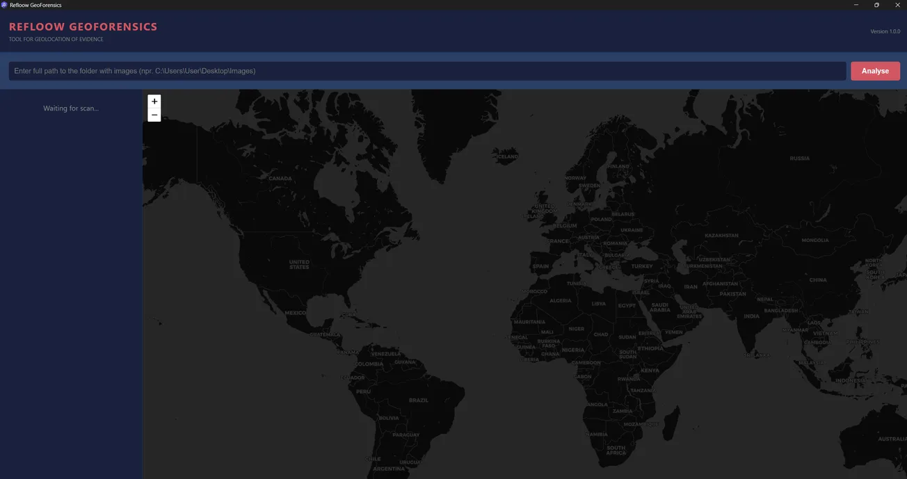
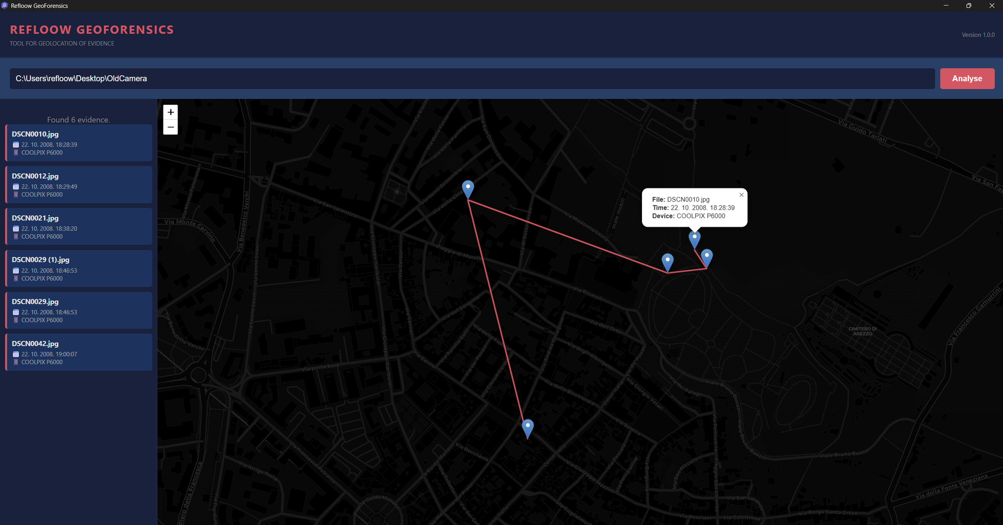
The core workflow is straightforward: point the tool at a directory of .jpg or .jpeg files, and it automatically parses the EXIF headers from every image in the batch. It extracts GPS coordinates, camera model information, and timestamps, then presents the results across three views.
// Key Features
// Technical Details
| Spec | Details |
|---|---|
| Framework | Electron (cross-platform desktop) |
| Runtime | Node.js v20.10.0+ |
| Core Libraries | express, exif-parser, electron |
| Platforms | Windows 10/11, macOS (Intel + Apple Silicon), Linux (Ubuntu/Debian) |
| Min. RAM | 2 GB (4 GB+ recommended for large batches) |
| Install Size | ~350 MB |
| Supported Formats | .jpg, .jpeg |
// Use Cases
Incident reconstruction. If you have a set of photos from a crime scene, protest, accident, or event, the timeline reconstruction feature lets you see the chronological sequence of when images were captured and where, helping establish a narrative of what happened.
Privacy auditing. Security-conscious individuals and organizations can use the tool to audit their own image collections for embedded GPS data before sharing or publishing photos. Many people don't realize their phone photos contain precise location coordinates in the EXIF data.
Journalism. Verifying the authenticity and origin of photos submitted as news tips or evidence. Checking whether the GPS coordinates and timestamps in an image's metadata are consistent with the claimed story.
// Considerations
JPG/JPEG only. The tool currently only processes .jpg and .jpeg files. Other common image formats like PNG, HEIC (used by iPhones), TIFF, or RAW camera formats are not supported. This is a meaningful limitation for investigators who may receive evidence in mixed formats.
EXIF dependency. The tool can only work with what's in the EXIF data. Many social media platforms (Twitter/X, Facebook, Instagram) strip EXIF metadata from uploaded images. Photos that have been screenshotted, re-saved, or processed through messaging apps typically lose their EXIF data as well.
Electron overhead. The ~350 MB install size is a consequence of Electron bundling a Chromium runtime. This is typical for Electron apps but worth noting compared to lightweight command-line alternatives like exiftool.
AGPL-3.0 license. The tool is licensed under the GNU Affero General Public License v3.0, which requires that any modifications to the source code be released under the same license. This is more restrictive than MIT/Apache and worth understanding if you plan to incorporate it into other projects.
// Bottom Line
Refloow Geo Forensics fills a niche for investigators and OSINT practitioners who need a quick, visual way to process batches of geotagged images without uploading anything to the cloud. The combination of batch EXIF extraction, interactive map visualization, and timeline reconstruction in a single desktop app makes it a useful addition to the OSINT toolkit, even at this early stage.
The JPG-only limitation and Electron overhead are real constraints, but for the specific use case of "I have a folder of JPGs and I need to see where and when they were taken," this tool gets the job done with minimal friction. It's worth watching as the project matures and expands format support.

